Milestone on the A64, Steeton
Introduction
The photograph on this page of Milestone on the A64, Steeton by JThomas as part of the Geograph project.
The Geograph project started in 2005 with the aim of publishing, organising and preserving representative images for every square kilometre of Great Britain, Ireland and the Isle of Man.

There are currently over 7.5m images from over 14,400 individuals and you can help contribute to the project by visiting https://www.geograph.org.uk
Milestone on the A64, Steeton
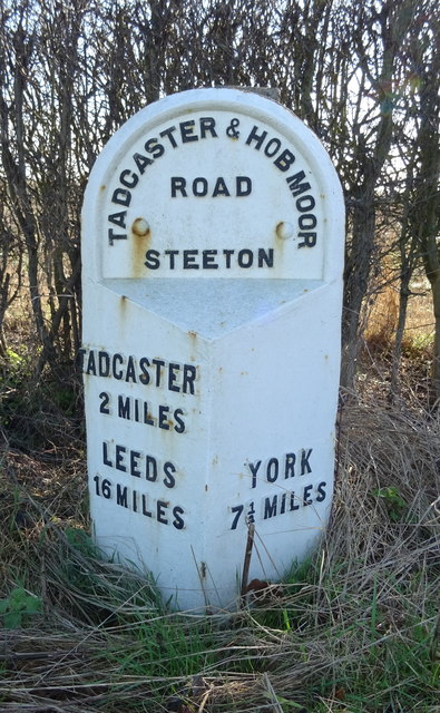
Image: © JThomas Taken: 8 Feb 2020
Inscription reads:- TADCASTER 2 MILES / LEEDS 16 MILES : YORK 7 1/2 MILES : TADCASTER & HOB MOOR ROAD STEETON Milestone Society National ID: YN_TCYO02. See Image] for context.
Images are licensed for reuse under creativecommons.org/licenses/by-sa/2.0
Image Location


Leaflet Map data © OpenStreetMap
Latitude
53.892945
Longitude
-1.215867