Land at Brunswick Street
Introduction
The photograph on this page of Land at Brunswick Street by John Baker as part of the Geograph project.
The Geograph project started in 2005 with the aim of publishing, organising and preserving representative images for every square kilometre of Great Britain, Ireland and the Isle of Man.

There are currently over 7.5m images from over 14,400 individuals and you can help contribute to the project by visiting https://www.geograph.org.uk
Land at Brunswick Street
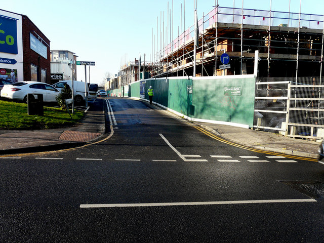
Image: © John Baker Taken: 21 Jan 2020
Planning permission was granted by Maidstone Borough Council under application number 17/504632/FULL for the “proposed demolition of all existing buildings and introduction of a new 33 space public car park, together with 24 flats in a four storey block fronting Upper Stone Street. A row of 6 houses constructed over 3 storeys fronting Orchard Street. 2 rows of 4 houses each constructed over 3 storeys fronting Brunswick Street, and George Street and 9 flats in a stepped block overlooking the new pay and display car park. The development will include allocated parking and soft landscaping”. The road straight ahead is George Street.
Images are licensed for reuse under creativecommons.org/licenses/by-sa/2.0
Image Location
Latitude
51.268686
Longitude
0.525683