Northern bastion of Cambridge Castle
Introduction
The photograph on this page of Northern bastion of Cambridge Castle by Tiger as part of the Geograph project.
The Geograph project started in 2005 with the aim of publishing, organising and preserving representative images for every square kilometre of Great Britain, Ireland and the Isle of Man.

There are currently over 7.5m images from over 14,400 individuals and you can help contribute to the project by visiting https://www.geograph.org.uk
Northern bastion of Cambridge Castle
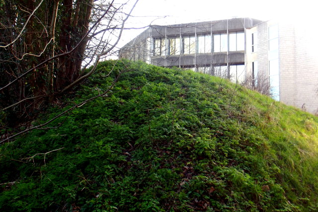
Image: © Tiger Taken: 1 Feb 2020
At the beginning of the English Civil War in 1642, Cambridge Castle was occupied by Parliamentary forces. The townsfolk mainly supported Oliver Cromwell, their local hero with his background in Huntingdon and Ely, but the University and Colleges were a hotbed of Royalism. Cromwell ordered the long-neglected fortifications to be beefed up as a defence against this threat, and so two earthen bastions of earth were hastily constructed. In the event no assaults took place and in 1647 the remains of the castle were slighted. The grassy mound seen here is the remains of the northern bastion, which stands on the eastern edge of the Shire Hall office site. Looming above it is the Octagon, part of the 1974 concrete extensions to the county offices, designed by John Pook of the County Architect's Department and dismissed by Simon Bradley in his 2014 revision of Pevsner's guide as "depressing". For a view from the opposite direction see Image
Images are licensed for reuse under creativecommons.org/licenses/by-sa/2.0
Image Location
Latitude
52.213593
Longitude
0.114167