Cirencester buildings [30]
Introduction
The photograph on this page of Cirencester buildings [30] by Michael Dibb as part of the Geograph project.
The Geograph project started in 2005 with the aim of publishing, organising and preserving representative images for every square kilometre of Great Britain, Ireland and the Isle of Man.

There are currently over 7.5m images from over 14,400 individuals and you can help contribute to the project by visiting https://www.geograph.org.uk
Cirencester buildings [30]
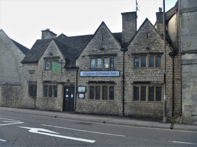
Image: © Michael Dibb Taken: 24 Sep 2019
The Waggon and Horses Inn was built in the 17th century and totally rebuilt in 1920 in the Cotswold vernacular style, similar to the original. Closed since January, 2018 permission has recently (September, 2019) been granted to convert the property into flats. Cirencester, the largest town in the Cotswolds, is a market town some 15 miles south east of Gloucester and some 13 miles north west of Swindon. The town lies on the River Churn, a tributary of the River Thames and is the hub of a network of roads. It is the home of the Royal Agricultural University, founded in 1840. An important Roman settlement known as Corinium, the town, with 240 acres enclosed by walls was second only to London in size.
Images are licensed for reuse under creativecommons.org/licenses/by-sa/2.0
Image Location
Latitude
51.716272
Longitude
-1.962029