Copthorne Road
Introduction
The photograph on this page of Copthorne Road by Ian Capper as part of the Geograph project.
The Geograph project started in 2005 with the aim of publishing, organising and preserving representative images for every square kilometre of Great Britain, Ireland and the Isle of Man.

There are currently over 7.5m images from over 14,400 individuals and you can help contribute to the project by visiting https://www.geograph.org.uk
Copthorne Road
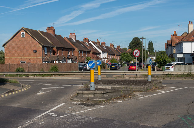
Image: © Ian Capper Taken: 13 Sep 2019
Looking across By Pass Road from the 1930s built southern section of Copthorne Road to the original section, built as a cul-de-sac off Barnett Wood Lane in the early 1900s before later being extended southwards. The northern section has since reverted to being a cul-de-sac, with crash barriers blocking it from By Pass Road, with maps suggesting that this was in the 1960s or 1970s.
Images are licensed for reuse under creativecommons.org/licenses/by-sa/2.0
Image Location
Latitude
51.303241
Longitude
-0.327563