Mousehole harbour, 1948
Introduction
The photograph on this page of Mousehole harbour, 1948 by David M Murray-Rust as part of the Geograph project.
The Geograph project started in 2005 with the aim of publishing, organising and preserving representative images for every square kilometre of Great Britain, Ireland and the Isle of Man.

There are currently over 7.5m images from over 14,400 individuals and you can help contribute to the project by visiting https://www.geograph.org.uk
Mousehole harbour, 1948
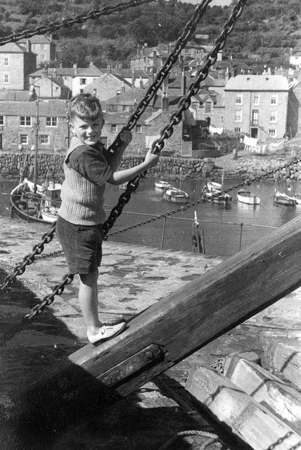
Image: © David M Murray-Rust Taken: 1 Aug 1948
At the end of the south pier looking towards The Wharf. The crane would have been used to drop the large timber baulks into slots in the walls of the harbour entrance to provide protection against abnormally high tides. Today this would be done with a mobile crane.
Images are licensed for reuse under creativecommons.org/licenses/by-sa/2.0
Image Location
Latitude
50.082529
Longitude
-5.539024