Banstead village well
Introduction
The photograph on this page of Banstead village well by Malc McDonald as part of the Geograph project.
The Geograph project started in 2005 with the aim of publishing, organising and preserving representative images for every square kilometre of Great Britain, Ireland and the Isle of Man.

There are currently over 7.5m images from over 14,400 individuals and you can help contribute to the project by visiting https://www.geograph.org.uk
Banstead village well
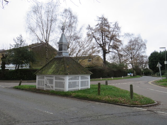
Image: © Malc McDonald Taken: 11 Jan 2020
This wooden building in Banstead is a wellhead. Within it, the well is 300 feet deep. The well head is a Grade II listed building, which was restored in 2003. More information about the well head is available on the Banstead History website: https://www.bansteadhistory.com/places_az.html , with another article describing the restoration: http://bansteadhistory.com/well_feature.html
Images are licensed for reuse under creativecommons.org/licenses/by-sa/2.0
Image Location
Latitude
51.324005
Longitude
-0.194393