Camlas Castell Nedd / Neath Canal
Introduction
The photograph on this page of Camlas Castell Nedd / Neath Canal by Alan Richards as part of the Geograph project.
The Geograph project started in 2005 with the aim of publishing, organising and preserving representative images for every square kilometre of Great Britain, Ireland and the Isle of Man.

There are currently over 7.5m images from over 14,400 individuals and you can help contribute to the project by visiting https://www.geograph.org.uk
Camlas Castell Nedd / Neath Canal
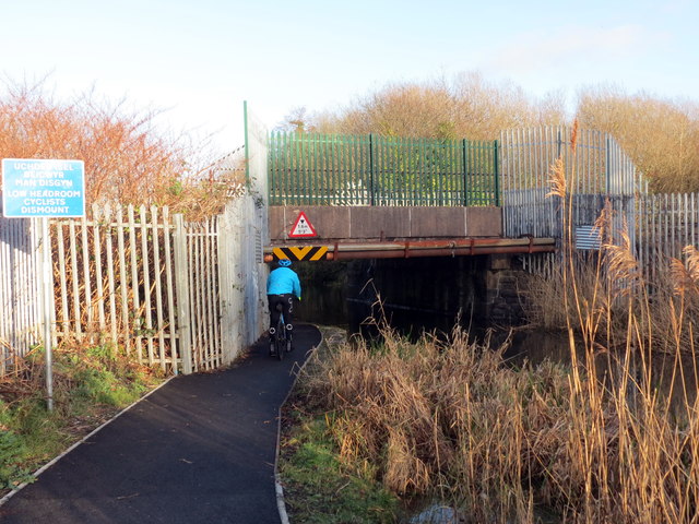
Image: © Alan Richards Taken: 10 Jan 2020
Camlas Castell Nedd yn mynd o dan bont reilffordd. Cwblheuwyd y gamlas yn 1799 er cludo glo i lawr y cwm i Giants Grave. Fe'i caewyd yn 1934. Mae'r llwybr halio bellach yn ffordd beicio. The Neath Canal going under a railway bridge. Completed in 1799 the canal transported coal from the Vale of Neath to Giants Grave. The former tow path is today a cycle way.
Images are licensed for reuse under creativecommons.org/licenses/by-sa/2.0
Image Location
Latitude
51.646881
Longitude
-3.825394