Flooded field beside A37
Introduction
The photograph on this page of Flooded field beside A37 by Derek Harper as part of the Geograph project.
The Geograph project started in 2005 with the aim of publishing, organising and preserving representative images for every square kilometre of Great Britain, Ireland and the Isle of Man.

There are currently over 7.5m images from over 14,400 individuals and you can help contribute to the project by visiting https://www.geograph.org.uk
Flooded field beside A37
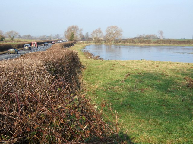
Image: © Derek Harper Taken: 18 Dec 2007
Taken close to the drive to Rushley Farm. The ground undulates slightly in this square, and I imagine this field is often flooded. A drain runs along the far side of it and across the A37, flowing left towards the Bearley Brook. At about 11.30 am, the sheet of water was still largely covered in ice. The A37 is here following the line of a Roman road from Dorchester to Ilchester.
Images are licensed for reuse under creativecommons.org/licenses/by-sa/2.0
Image Location


Leaflet Map data © OpenStreetMap
Latitude
50.980154
Longitude
-2.675151