38 - 39 and 39a St Paul's Square
Introduction
The photograph on this page of 38 - 39 and 39a St Paul's Square by Ian Capper as part of the Geograph project.
The Geograph project started in 2005 with the aim of publishing, organising and preserving representative images for every square kilometre of Great Britain, Ireland and the Isle of Man.

There are currently over 7.5m images from over 14,400 individuals and you can help contribute to the project by visiting https://www.geograph.org.uk
38 - 39 and 39a St Paul's Square
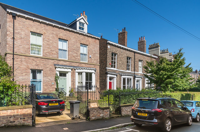
Image: © Ian Capper Taken: 17 Aug 2019
St Paul's Square is York's only "square", built c1855 and consisting of three storeyed terraced houses built in an elongated crescent surrounding a private central garden of lawn, shrubs and mature trees. Originally this section, south of Watson Terrace (previously Belgrave Street), connecting the square to Holgate Road, was called St Paul's Road, but by the time of the 1962 1:1,250 map it was shown as an extension of St Paul's Square, with the houses numbered accordingly. Nos 38 - 39, the building on the right of the photo, is of the same era as the main square and is grade II listed - see www.historicengland.org.uk/listing/the-list/list-entry/1256753. Despite appearances, no 39a, on the left of the photo, is modern, planning permission only having been granted until around 2010 for building on what previously had been a garden.
Images are licensed for reuse under creativecommons.org/licenses/by-sa/2.0
Image Location
Latitude
53.954659
Longitude
-1.101834