Portland Road
Introduction
The photograph on this page of Portland Road by Ian Capper as part of the Geograph project.
The Geograph project started in 2005 with the aim of publishing, organising and preserving representative images for every square kilometre of Great Britain, Ireland and the Isle of Man.

There are currently over 7.5m images from over 14,400 individuals and you can help contribute to the project by visiting https://www.geograph.org.uk
Portland Road
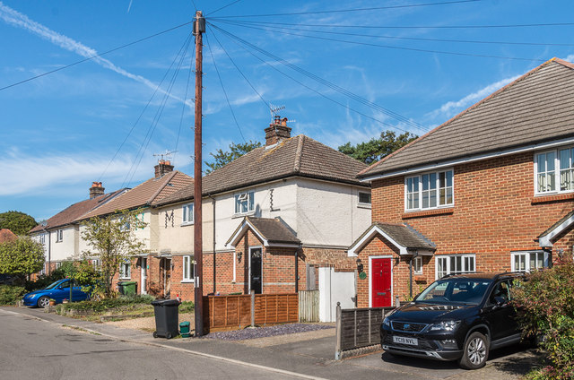
Image: © Ian Capper Taken: 13 Sep 2019
c1930s housing (other than the building on the right, which was one of three buildings, Portland Cottages, built in the early 21st Century on the site of a factory called Trimster House). What is unusual about this road is that the original houses were lettered not numbered, with the letters built into the walls of each house in coloured bricks, as can clearly be seen here on the pair of houses in the centre of this photo.
Images are licensed for reuse under creativecommons.org/licenses/by-sa/2.0
Image Location
Latitude
51.234206
Longitude
-0.335267