Old Milestone by the A389 at Mount Charles
Introduction
The photograph on this page of Old Milestone by the A389 at Mount Charles by Rosy Hanns as part of the Geograph project.
The Geograph project started in 2005 with the aim of publishing, organising and preserving representative images for every square kilometre of Great Britain, Ireland and the Isle of Man.

There are currently over 7.5m images from over 14,400 individuals and you can help contribute to the project by visiting https://www.geograph.org.uk
Old Milestone by the A389 at Mount Charles
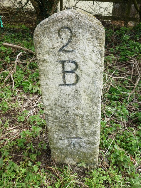
Image: © Rosy Hanns Taken: 22 Mar 2019
Carved stone post by the A389, in parish of BODMIN (NORTH CORNWALL District), Mount Charles Gate, near Dunmere Wood, South of B3266 junction, on the verge, on East side of road. Bodmin 'B' Gravestone, erected by the Bodmin turnpike trust in the 18th century. Inscription reads:- 2 B Carved benchmark on lower front face. Grade II listed. List Entry Number: 1143101 https://historicengland.org.uk/listing/the-list/list-entry/1143101 Milestone Society National ID: CW_BMWB02.
Images are licensed for reuse under creativecommons.org/licenses/by-sa/2.0
Image Location


Leaflet Map data © OpenStreetMap
Latitude
50.486528
Longitude
-4.761636