Old Milestone by the A389, west of Bodmin
Introduction
The photograph on this page of Old Milestone by the A389, west of Bodmin by Rosy Hanns as part of the Geograph project.
The Geograph project started in 2005 with the aim of publishing, organising and preserving representative images for every square kilometre of Great Britain, Ireland and the Isle of Man.

There are currently over 7.5m images from over 14,400 individuals and you can help contribute to the project by visiting https://www.geograph.org.uk
Old Milestone by the A389, west of Bodmin
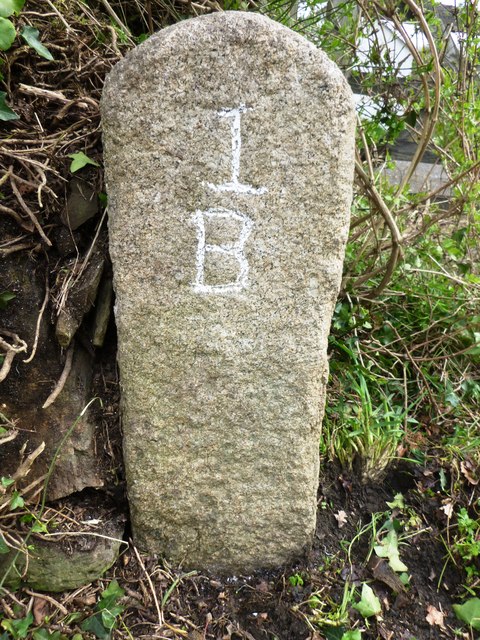
Image: © Rosy Hanns Taken: 22 Mar 2019
Carved stone post by the A389, in parish of BODMIN (NORTH CORNWALL District), St Anne's Chapel, South of Dunmere bridge, opposite South end of car park of Borough Arms PH, at end of hedge bank, by gate, on East side of road. Bodmin 'B' Gravestone, erected by the Bodmin turnpike trust in the 18th century. Inscription reads:- 1 B Cornwall & Scilly HER. HER Number: 178391 https://www.heritagegateway.org.uk/Gateway/Results_Single.aspx?uid=MCO54167&resourceID=1020 Milestone Society National ID: CW_BMWB01.
Images are licensed for reuse under creativecommons.org/licenses/by-sa/2.0
Image Location
Latitude
50.474756
Longitude
-4.752422