Ascending the Department for Communities path to Moyry Castle
Introduction
The photograph on this page of Ascending the Department for Communities path to Moyry Castle by Eric Jones as part of the Geograph project.
The Geograph project started in 2005 with the aim of publishing, organising and preserving representative images for every square kilometre of Great Britain, Ireland and the Isle of Man.

There are currently over 7.5m images from over 14,400 individuals and you can help contribute to the project by visiting https://www.geograph.org.uk
Ascending the Department for Communities path to Moyry Castle
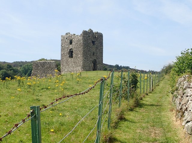
Image: © Eric Jones Taken: 2 Aug 2019
This early 17thC tower house is a scheduled monument maintained by the Department for Communities. The site contains a three storey tower house and a fragment of a bawn (courtyard) wall. https://apps.communities-ni.gov.uk/nismr-public/docs/ARM/ARM_032/ARM_032_005/Public/SM7-ARM-032-005-002.pdf
Images are licensed for reuse under creativecommons.org/licenses/by-sa/2.0
Image Location
Latitude
54.070382
Longitude
-6.385064