Masjid ul-Emaan
Introduction
The photograph on this page of Masjid ul-Emaan by Ian Capper as part of the Geograph project.
The Geograph project started in 2005 with the aim of publishing, organising and preserving representative images for every square kilometre of Great Britain, Ireland and the Isle of Man.

There are currently over 7.5m images from over 14,400 individuals and you can help contribute to the project by visiting https://www.geograph.org.uk
Masjid ul-Emaan
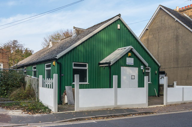
Image: © Ian Capper Taken: 31 Oct 2019
The former Battlebridge Hall, a "tin tabernacle" dating from the early 20th Century, now used as an Islamic community education centre. See Image for a photo from 2008.
Images are licensed for reuse under creativecommons.org/licenses/by-sa/2.0
Image Location
Latitude
51.25224
Longitude
-0.15837