Cricklade houses [51]
Introduction
The photograph on this page of Cricklade houses [51] by Michael Dibb as part of the Geograph project.
The Geograph project started in 2005 with the aim of publishing, organising and preserving representative images for every square kilometre of Great Britain, Ireland and the Isle of Man.

There are currently over 7.5m images from over 14,400 individuals and you can help contribute to the project by visiting https://www.geograph.org.uk
Cricklade houses [51]
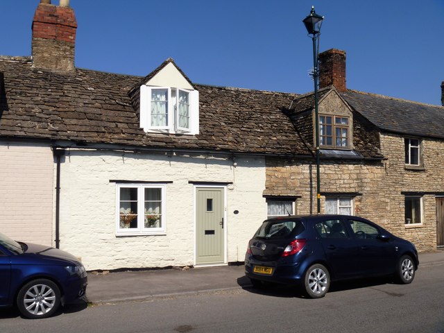
Image: © Michael Dibb Taken: 25 Aug 2019
Number 21 (nearest the camera) and number 22 Calcott Street, seen here, are, along with numbers 19A and 20, the remains of a row of seven houses built in the 1730s to create votes. They stand just outside the walls of the Saxon burgh and were much discussed in the disputed parliamentary election of 1774. There are brief details and links at: https://en.wikipedia.org/wiki/Cricklade_(UK_Parliament_constituency) Number 22 has had its door removed and has been merged with number 23. The row of four houses is listed for historical reasons with details at: https://historicengland.org.uk/listing/the-list/list-entry/1023091 Cricklade is the first town downstream on the River Thames. The town was founded by the Anglo-Saxons in the 9th century at the point where the Roman Ermin Way crosses the River Thames. It is one of the thirty burhs (fortified towns) recorded in the Burghal Hidage document, which describes a system of fortresses and fortified towns built around Wessex by King Alfred. The fortifications have been extensively excavated in several places on all four of its sides.
Images are licensed for reuse under creativecommons.org/licenses/by-sa/2.0
Image Location
Latitude
51.640389
Longitude
-1.851689