Church Gardens
Introduction
The photograph on this page of Church Gardens by Ian Capper as part of the Geograph project.
The Geograph project started in 2005 with the aim of publishing, organising and preserving representative images for every square kilometre of Great Britain, Ireland and the Isle of Man.

There are currently over 7.5m images from over 14,400 individuals and you can help contribute to the project by visiting https://www.geograph.org.uk
Church Gardens
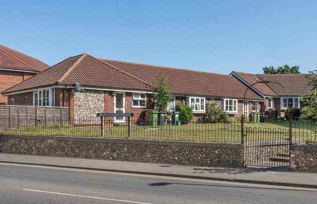
Image: © Ian Capper Taken: 18 Sep 2019
c1980s bungalows in the grounds of All Saints' Church Centre on Kingston Road. The church was re-ordered and rededicated in 1982 (see Image), and so the building of these bungalows may have coincided with that work.
Images are licensed for reuse under creativecommons.org/licenses/by-sa/2.0
Image Location
Latitude
51.302583
Longitude
-0.329394