Cricklade houses [19]
Introduction
The photograph on this page of Cricklade houses [19] by Michael Dibb as part of the Geograph project.
The Geograph project started in 2005 with the aim of publishing, organising and preserving representative images for every square kilometre of Great Britain, Ireland and the Isle of Man.

There are currently over 7.5m images from over 14,400 individuals and you can help contribute to the project by visiting https://www.geograph.org.uk
Cricklade houses [19]
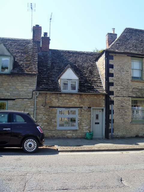
Image: © Michael Dibb Taken: 25 Aug 2019
Number 67 High Street, Little Cottage, is 17th or 18th century and is listed for group value, grade II, with details at: https://historicengland.org.uk/listing/the-list/list-entry/1183194 Cricklade is the first town downstream on the River Thames. The town was founded by the Anglo-Saxons in the 9th century at the point where the Roman Ermin Way crosses the River Thames. It is one of the thirty burhs (fortified towns) recorded in the Burghal Hidage document, which describes a system of fortresses and fortified towns built around Wessex by King Alfred. The fortifications have been extensively excavated in several places on all four of its sides.
Images are licensed for reuse under creativecommons.org/licenses/by-sa/2.0
Image Location
Latitude
51.64408
Longitude
-1.854856