Lilliput Farm
Introduction
The photograph on this page of Lilliput Farm by Derek Harper as part of the Geograph project.
The Geograph project started in 2005 with the aim of publishing, organising and preserving representative images for every square kilometre of Great Britain, Ireland and the Isle of Man.

There are currently over 7.5m images from over 14,400 individuals and you can help contribute to the project by visiting https://www.geograph.org.uk
Lilliput Farm
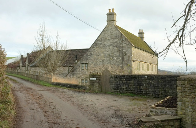
Image: © Derek Harper Taken: 7 Dec 2019
The farmhouse by Hall Lane is listed https://historicengland.org.uk/listing/the-list/list-entry/1290707 and has a catslide roof. Hall Lane is a no through road, although it leads to rights of way including the Cotswold Way.
Images are licensed for reuse under creativecommons.org/licenses/by-sa/2.0
Image Location
Latitude
51.438433
Longitude
-2.387819