End of the line on Wigmore Road
Introduction
The photograph on this page of End of the line on Wigmore Road by Nick Smith as part of the Geograph project.
The Geograph project started in 2005 with the aim of publishing, organising and preserving representative images for every square kilometre of Great Britain, Ireland and the Isle of Man.

There are currently over 7.5m images from over 14,400 individuals and you can help contribute to the project by visiting https://www.geograph.org.uk
End of the line on Wigmore Road
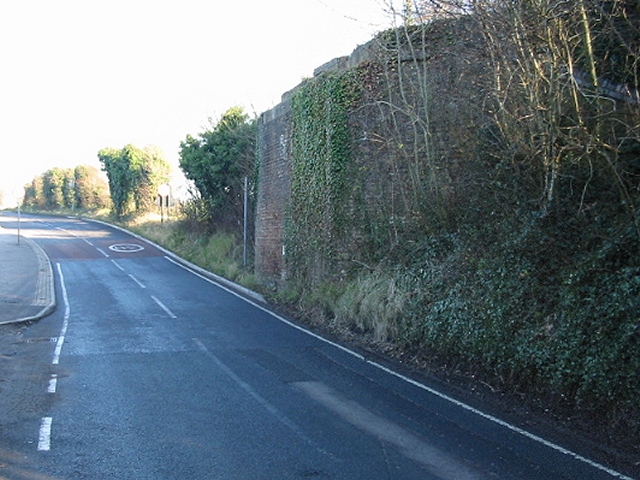
Image: © Nick Smith Taken: 15 Dec 2007
The brickwork on the right is the remains of a bridge which carried the old East Kent Light Railway which served Tilmanstone colliery. A small section (~2 miles) of the railway has been preserved as the East Kent Railway, this is the Northern end of the preserved track.
Images are licensed for reuse under creativecommons.org/licenses/by-sa/2.0
Image Location
Latitude
51.203824
Longitude
1.270366