Limekiln Bridge south of Trentham in Stoke-on-Trent
Introduction
The photograph on this page of Limekiln Bridge south of Trentham in Stoke-on-Trent by Roger Kidd as part of the Geograph project.
The Geograph project started in 2005 with the aim of publishing, organising and preserving representative images for every square kilometre of Great Britain, Ireland and the Isle of Man.

There are currently over 7.5m images from over 14,400 individuals and you can help contribute to the project by visiting https://www.geograph.org.uk
Limekiln Bridge south of Trentham in Stoke-on-Trent
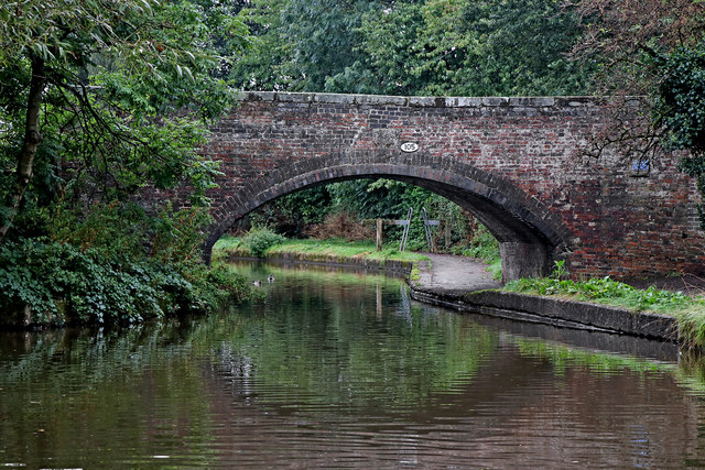
Image: © Roger Kidd Taken: 16 Sep 2019
This is the Trent and Mersey Canal, looking south towards Limekiln Bridge, No 105. The bridge was originally just an accommodation bridge linking fields south of Newpark Farm, but housing has now spread across both sides of the canal, and the bridge now carries a public footpath.
Images are licensed for reuse under creativecommons.org/licenses/by-sa/2.0
Image Location
Latitude
52.958048
Longitude
-2.177846