Melville Close, Branston
Introduction
The photograph on this page of Melville Close, Branston by Jo and Steve Turner as part of the Geograph project.
The Geograph project started in 2005 with the aim of publishing, organising and preserving representative images for every square kilometre of Great Britain, Ireland and the Isle of Man.

There are currently over 7.5m images from over 14,400 individuals and you can help contribute to the project by visiting https://www.geograph.org.uk
Melville Close, Branston
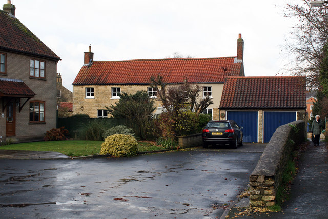
Image: © Jo and Steve Turner Taken: 28 Nov 2019
Grade II Listed 18th century house. Listed as Co-op House a former farm house it is apparently now 4 Melville Close. The north-eastern two bays appear to be a later addition when compared to the profile and position of the building on late 19th and early 20th century maps. Indeed visually the two right hand bays that are rendered appear to have narrower first floor windows and it is possible it was two dwellings at some stage.
Images are licensed for reuse under creativecommons.org/licenses/by-sa/2.0
Image Location
Latitude
53.192353
Longitude
-0.472228