Ysgoldy, Pandy, Llanuwchllyn
Introduction
The photograph on this page of Ysgoldy, Pandy, Llanuwchllyn by Eirian Evans as part of the Geograph project.
The Geograph project started in 2005 with the aim of publishing, organising and preserving representative images for every square kilometre of Great Britain, Ireland and the Isle of Man.

There are currently over 7.5m images from over 14,400 individuals and you can help contribute to the project by visiting https://www.geograph.org.uk
Ysgoldy, Pandy, Llanuwchllyn
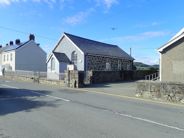
Image: © Eirian Evans Taken: 13 Aug 2019
Independent chapel on the main road in Pandy. It was built c.1900 in the Simple Round-Headed style with an entrance in the gable end. In 1997 Ysgoldy was still being used as a chapel but by 2003 it had become a children's activity centre.
Images are licensed for reuse under creativecommons.org/licenses/by-sa/2.0
Image Location
Latitude
52.85592
Longitude
-3.669422