A peculiar path
Introduction
The photograph on this page of A peculiar path by Gordon Hatton as part of the Geograph project.
The Geograph project started in 2005 with the aim of publishing, organising and preserving representative images for every square kilometre of Great Britain, Ireland and the Isle of Man.

There are currently over 7.5m images from over 14,400 individuals and you can help contribute to the project by visiting https://www.geograph.org.uk
A peculiar path
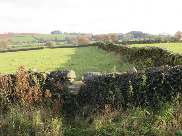
Image: © Gordon Hatton Taken: 13 Nov 2019
The OS map shows this path along the south side of the wall seen on the right, but the stile is on the north side. The same is shown on NYCC's footpath map, so one wonders what the exact line should be. There is no roadside signpost either. On this occasion the field beyond the stile was a wet morass, made worse by cattle churning up the surface.
Images are licensed for reuse under creativecommons.org/licenses/by-sa/2.0
Image Location
Latitude
54.023163
Longitude
-1.683548