Renton War Memorial
Introduction
The photograph on this page of Renton War Memorial by Lairich Rig as part of the Geograph project.
The Geograph project started in 2005 with the aim of publishing, organising and preserving representative images for every square kilometre of Great Britain, Ireland and the Isle of Man.

There are currently over 7.5m images from over 14,400 individuals and you can help contribute to the project by visiting https://www.geograph.org.uk
Renton War Memorial
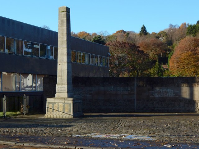
Image: © Lairich Rig Taken: 10 Nov 2019
The day the picture was taken was, by coincidence, Remembrance Sunday. The memorial originally stood at the southern edge of the village, on the other side of the road from Image (aka Tontine Park). It is shown here beside Renton Primary School. The text on the curving wall behind it is not related to the war memorial, but is a translation of the Latin text on Image, which is just out of shot to the right.
Images are licensed for reuse under creativecommons.org/licenses/by-sa/2.0
Image Location
Latitude
55.969479
Longitude
-4.584299