Gravel Hill
Introduction
The photograph on this page of Gravel Hill by Ian Capper as part of the Geograph project.
The Geograph project started in 2005 with the aim of publishing, organising and preserving representative images for every square kilometre of Great Britain, Ireland and the Isle of Man.

There are currently over 7.5m images from over 14,400 individuals and you can help contribute to the project by visiting https://www.geograph.org.uk
Gravel Hill
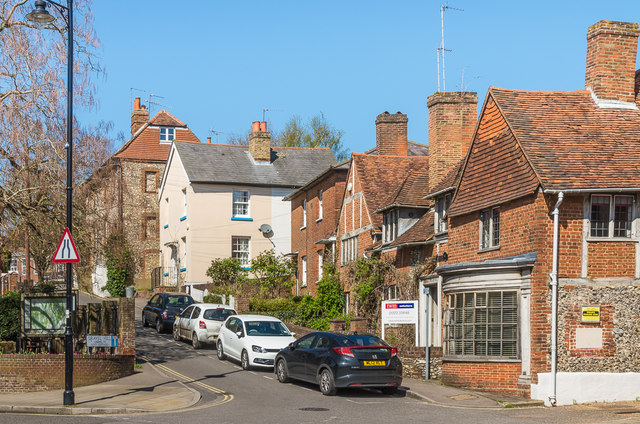
Image: © Ian Capper Taken: 10 Apr 2019
Looking up Gravel Hill from North Street. The nearest building is Sweech House, originally three buildings, with the nearest section thought to date from the late 15th Century, the other parts from the 16th Century. It is now used for by a firm of solicitors. Grade II listed - see www.historicengland.org.uk/listing/the-list/list-entry/1028622.
Images are licensed for reuse under creativecommons.org/licenses/by-sa/2.0
Image Location
Latitude
51.296004
Longitude
-0.330264