An unusual name
Introduction
The photograph on this page of An unusual name by Marathon as part of the Geograph project.
The Geograph project started in 2005 with the aim of publishing, organising and preserving representative images for every square kilometre of Great Britain, Ireland and the Isle of Man.

There are currently over 7.5m images from over 14,400 individuals and you can help contribute to the project by visiting https://www.geograph.org.uk
An unusual name
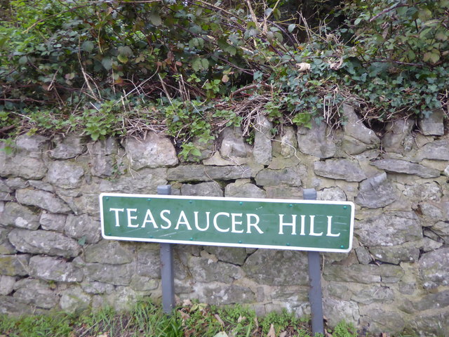
Image: © Marathon Taken: 9 Nov 2019
Teasaucer Hill leads steeply down from Cripple Street on the edge of Loose near Maidstone into the Loose Valley at Hayle Mill Road. The name is intriguing and I can only assume it is something to do with the shape of a tea saucer.
Images are licensed for reuse under creativecommons.org/licenses/by-sa/2.0
Image Location
Latitude
51.25539
Longitude
0.516641