St. Mary Magdalen, Westoning
Introduction
The photograph on this page of St. Mary Magdalen, Westoning by Rob Farrow as part of the Geograph project.
The Geograph project started in 2005 with the aim of publishing, organising and preserving representative images for every square kilometre of Great Britain, Ireland and the Isle of Man.

There are currently over 7.5m images from over 14,400 individuals and you can help contribute to the project by visiting https://www.geograph.org.uk
St. Mary Magdalen, Westoning
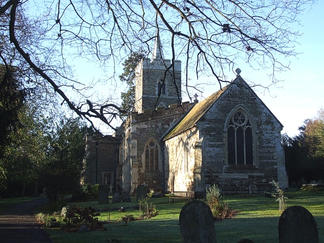
Image: © Rob Farrow Taken: 12 Dec 2007
A view of this neat little church tucked away near the end of a no-through-road to the west of the main part of the village. This shot was taken from the churchyard near to the gate. Note that the church is aligned unusually (NE/SW) as opposed to the usual (East/West) such that the chancel (in the forefront here) is pointing northeastwards rather than to the east.
Images are licensed for reuse under creativecommons.org/licenses/by-sa/2.0
Image Location
Latitude
51.984063
Longitude
-0.504214