Hythe Road (A20)
Introduction
The photograph on this page of Hythe Road (A20) by John Baker as part of the Geograph project.
The Geograph project started in 2005 with the aim of publishing, organising and preserving representative images for every square kilometre of Great Britain, Ireland and the Isle of Man.

There are currently over 7.5m images from over 14,400 individuals and you can help contribute to the project by visiting https://www.geograph.org.uk
Hythe Road (A20)
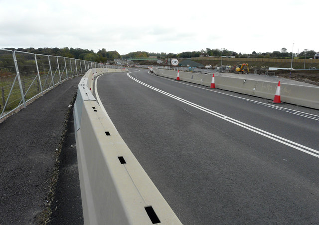
Image: © John Baker Taken: 20 Oct 2019
This part of the road has been realigned. This was Image looking northwest in April 2019. Highways England started work to build a new junction on the M20 (Junction 10A) 700 metres south east of Junction 10 in January 2018. The new junction will include a roundabout over the motorway, new slip roads and a new link road to the A2070 Bad Munstereifel Road, with traffic signals on parts of the junction and two 3 lane bridges. The east-facing slip roads at the existing junction 10 will be removed. The A20 Hythe Road will be incorporated into the new junction so that the traffic in both directions would travel via the new roundabout. Highways England will construct a new pedestrian and cycle bridge over the M20 from Kingsford Street to the A20, demolishing the existing Highfield Lane Bridge. The Church Road footbridge will be replaced with a new bridge for cyclists and pedestrians. The works are due to be completed in May 2020 https://www.kent.gov.uk/roads-and-travel/what-we-look-after/roads/road-projects/in-progress-road-projects/m20-junction-10a-new-junction#
Images are licensed for reuse under creativecommons.org/licenses/by-sa/2.0
Image Location
Latitude
51.132708
Longitude
0.922803