Weir for Eardington Upper Forge
Introduction
The photograph on this page of Weir for Eardington Upper Forge by Chris Hodrien as part of the Geograph project.
The Geograph project started in 2005 with the aim of publishing, organising and preserving representative images for every square kilometre of Great Britain, Ireland and the Isle of Man.

There are currently over 7.5m images from over 14,400 individuals and you can help contribute to the project by visiting https://www.geograph.org.uk
Weir for Eardington Upper Forge
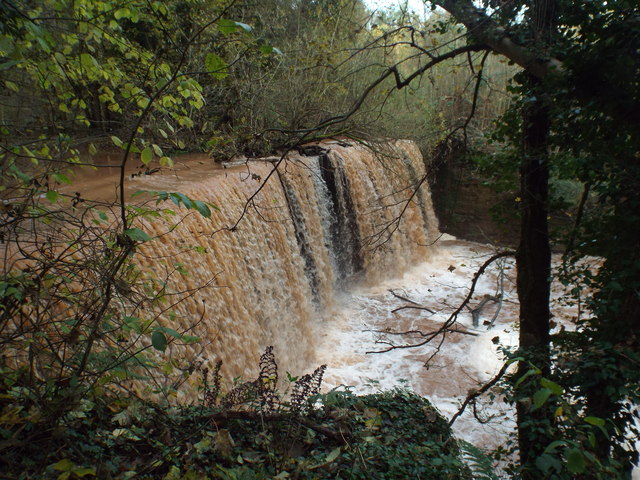
Image: © Chris Hodrien Taken: 10 Nov 2019
This is on the Mor Brook and is a masonry dam 30 yards long and raising the water level by 15'. Sluices supplied the Upper Forge and the tail race from there constituted a navigable canal and water supply to the Lower Forge. This is the most spectacular publicly accessible remnant of the Upper Forge as the other remains are in a trout farm and not accessible. The pond behind the dam/weir is now very largely silted up. The forges made fine charcoal iron for gun barrels, wire and horseshoe nails.
Images are licensed for reuse under creativecommons.org/licenses/by-sa/2.0
Image Location
Latitude
52.504135
Longitude
-2.407449