Coal tax boundary obelisk no.52, west of Eastbury Road
Introduction
The photograph on this page of Coal tax boundary obelisk no.52, west of Eastbury Road by Mike Quinn as part of the Geograph project.
The Geograph project started in 2005 with the aim of publishing, organising and preserving representative images for every square kilometre of Great Britain, Ireland and the Isle of Man.

There are currently over 7.5m images from over 14,400 individuals and you can help contribute to the project by visiting https://www.geograph.org.uk
Coal tax boundary obelisk no.52, west of Eastbury Road
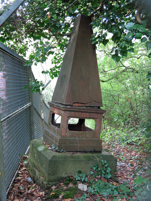
Image: © Mike Quinn Taken: 9 Oct 2019
The location of this obelisk is shown in Image and Image The obelisk is Grade II listed https://historicengland.org.uk/listing/the-list/list-entry/1348237 . There were originally 10 of these cast iron obelisks, just under 6ft high, of which only 6 are extant http://www.coaldutyposts.org.uk/cityposts.html . They were erected on the then boundary of the Metropolitan Police District by railways that were opened from 1865 onwards.
Images are licensed for reuse under creativecommons.org/licenses/by-sa/2.0
Image Location
Latitude
51.616789
Longitude
-0.424598