Gate, Pill Lane
Introduction
The photograph on this page of Gate, Pill Lane by Derek Harper as part of the Geograph project.
The Geograph project started in 2005 with the aim of publishing, organising and preserving representative images for every square kilometre of Great Britain, Ireland and the Isle of Man.

There are currently over 7.5m images from over 14,400 individuals and you can help contribute to the project by visiting https://www.geograph.org.uk
Gate, Pill Lane
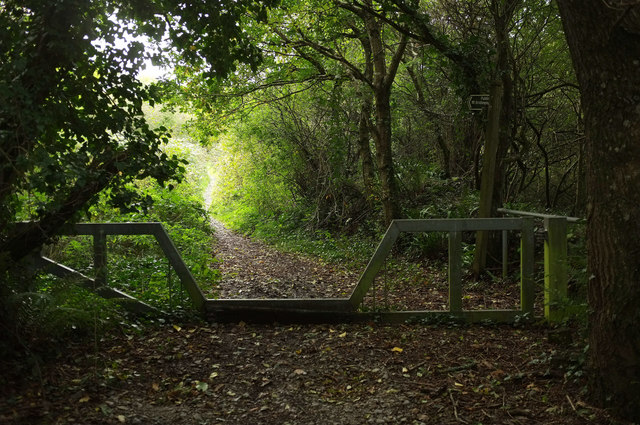
Image: © Derek Harper Taken: 19 Oct 2019
This seems to mark the spot at which the route with public access from the east becomes bridleway 636 9/1, whose line soon veers right to run beside the A38. The character of the right of way also changes from a fairly wide and level green lane to a climbing narrow footpath, frequently occupied by a small stream. This gate can be made out in Image], and is a match for the one shown in Image] at the other end of the bridleway.
Images are licensed for reuse under creativecommons.org/licenses/by-sa/2.0
Image Location
Latitude
50.418554
Longitude
-4.225541