
Ingleby Greenhow Church
Introduction
The photograph on this page of Ingleby Greenhow Church by Mick Garratt as part of the Geograph project.
The Geograph project started in 2005 with the aim of publishing, organising and preserving representative images for every square kilometre of Great Britain, Ireland and the Isle of Man.

There are currently over 7.5m images from over 14,400 individuals and you can help contribute to the project by visiting https://www.geograph.org.uk
Ingleby Greenhow Church
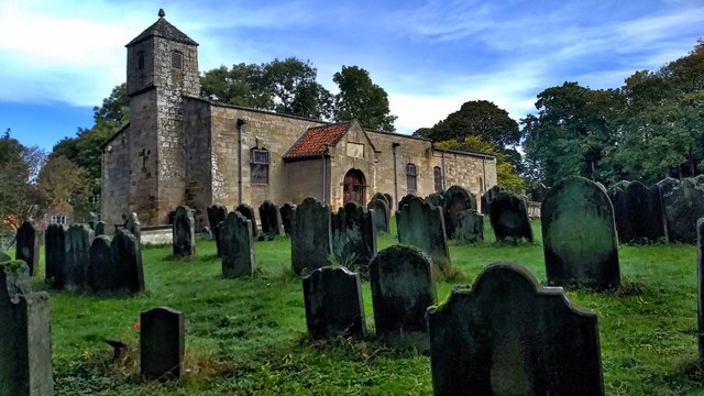
Image: © Mick Garratt Taken: 14 Oct 2019
I am not into religion but churches are usually the oldest building in a village so they have a certain fascination. St Andrew’s Church is odd-looking, low and squat with a bell tower that looks out of place. According to the inscription over the door, the church was rebuilt in 1741 but some of the base courses have been dated to the 12th century. No doubt a church existed on the site many centuries before that, the village name ‘Ingleby’ suggesting a settlement of Angles amongst an area dominated by Scandinavian settlers. Apparently, on either side of the chancel arch, there are ‘hagioscopes‘, holes cut through the stonework to allow a view of the altar from pews which would otherwise be out of sight. From my photo-diary for 14th October 2019 see http://www.fhithich.uk/?p=21774
Images are licensed for reuse under creativecommons.org/licenses/by-sa/2.0
Image Location

Latitude
54.448517
Longitude
-1.10582