
WWII defences in the environs of Bournemouth & Christchurch: Cleveland Rd Pillbox (3)
Introduction
The photograph on this page of WWII defences in the environs of Bournemouth & Christchurch: Cleveland Rd Pillbox (3) by Mike Searle as part of the Geograph project.
The Geograph project started in 2005 with the aim of publishing, organising and preserving representative images for every square kilometre of Great Britain, Ireland and the Isle of Man.

There are currently over 7.5m images from over 14,400 individuals and you can help contribute to the project by visiting https://www.geograph.org.uk
WWII defences in the environs of Bournemouth & Christchurch: Cleveland Rd Pillbox (3)
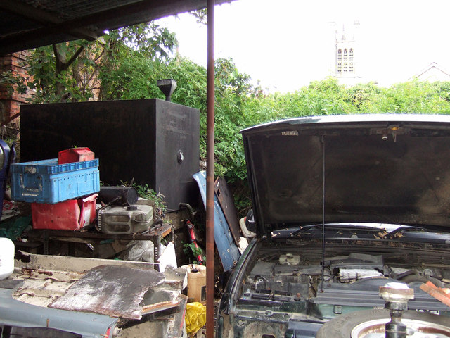
Image: © Mike Searle Taken: 10 Oct 2019
- Pillbox: EDoB ID: e44902 The second pillbox is also north of the stop-line formed by the railway, and is in opposition on the west side of the Cleveland Road railway bridge in the yard of a business premises. Previously thought to have been removed on account of it being completely invisible from the bridge, it is however extant, albeit buried by the railway embankment and the detritus of a garage premises. The reinforced concrete roof of the pillbox is just visible below the large oil tank which is mounted upon it. Part of the railway bridge parapet can be seen on the left, and in the background is the faint outline of the tower of St Clements Church. Image
Images are licensed for reuse under creativecommons.org/licenses/by-sa/2.0
Image Location

Latitude
50.729413
Longitude
-1.850612