Wells houses [8]
Introduction
The photograph on this page of Wells houses [8] by Michael Dibb as part of the Geograph project.
The Geograph project started in 2005 with the aim of publishing, organising and preserving representative images for every square kilometre of Great Britain, Ireland and the Isle of Man.

There are currently over 7.5m images from over 14,400 individuals and you can help contribute to the project by visiting https://www.geograph.org.uk
Wells houses [8]
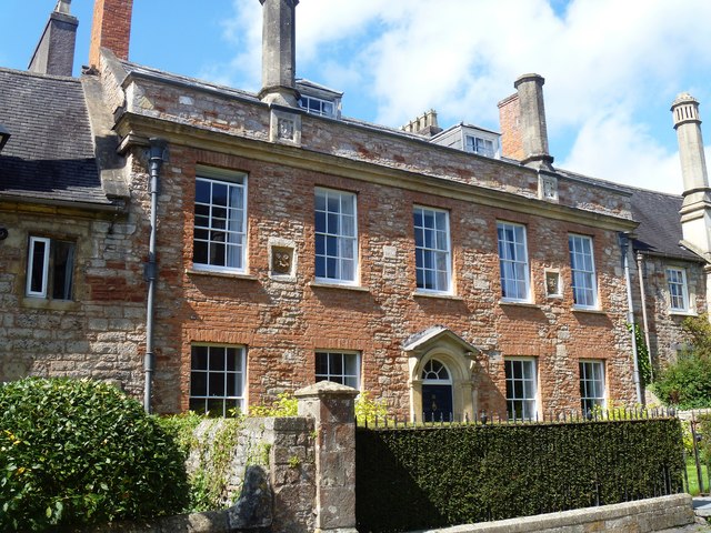
Image: © Michael Dibb Taken: 23 Aug 2019
Number 16 Vicar's Close. This wide 5-bay property, incorporating two original properties, appears to have been almost completely rebuilt in the late 18th century. Vicar's Close is a double row of houses enclosing a street of about 140 metres. There were originally 44 houses, now 27, with some units combined into a single dwelling. Built circa 1360 for the Vicars Choral there have been various rear extensions in the 16th, 17th and 18th centuries with refenestration in the 18th and early 19th centuries. The properties were extensively restored between 1976 and 1983. Numbers 14 to 27 are listed, grade I, with details at: https://historicengland.org.uk/listing/the-list/list-entry/1383199 The boundary walls to these houses are listed, grade I, with details at: https://historicengland.org.uk/listing/the-list/list-entry/1383200 A Roman settlement around three wells that became much more important when the Anglo-Saxon King Ine of Wessex founded a minster church in 704, Wells is the second smallest city in England.
Images are licensed for reuse under creativecommons.org/licenses/by-sa/2.0
Image Location
Latitude
51.211699
Longitude
-2.64403