Marple Locks No 12, Stockport
Introduction
The photograph on this page of Marple Locks No 12, Stockport by Roger Kidd as part of the Geograph project.
The Geograph project started in 2005 with the aim of publishing, organising and preserving representative images for every square kilometre of Great Britain, Ireland and the Isle of Man.

There are currently over 7.5m images from over 14,400 individuals and you can help contribute to the project by visiting https://www.geograph.org.uk
Marple Locks No 12, Stockport
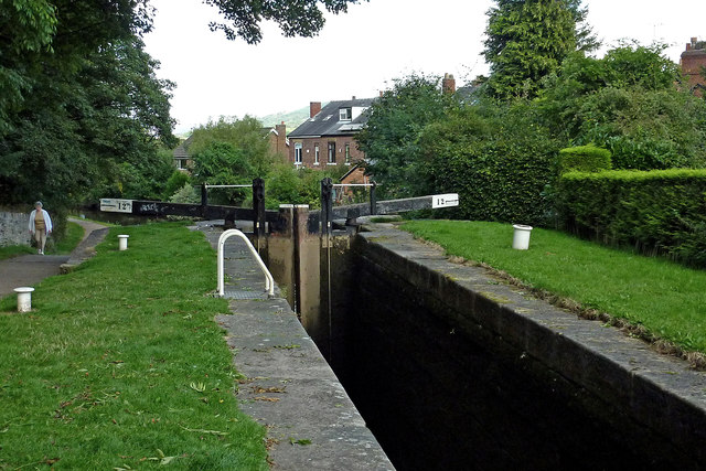
Image: © Roger Kidd Taken: 7 Sep 2014
Lock No 12. The housing is in St Martin's Road. The Marple flight on the Peak Forest Canal consists of sixteen deep locks in a mile. The total fall (or rise) provided is 209ft 6in (almost 64 metres). The canal was opened to navigation by 1796 but not enough money remained to build these locks. A temporary tramway was installed and used until 1804, when the locks were completed.
Images are licensed for reuse under creativecommons.org/licenses/by-sa/2.0
Image Location
Latitude
53.395746
Longitude
-2.059512