(Part of) the Swing Bridge, Sandhill, and the Keep
Introduction
The photograph on this page of (Part of) the Swing Bridge, Sandhill, and the Keep by Mike Quinn as part of the Geograph project.
The Geograph project started in 2005 with the aim of publishing, organising and preserving representative images for every square kilometre of Great Britain, Ireland and the Isle of Man.

There are currently over 7.5m images from over 14,400 individuals and you can help contribute to the project by visiting https://www.geograph.org.uk
(Part of) the Swing Bridge, Sandhill, and the Keep
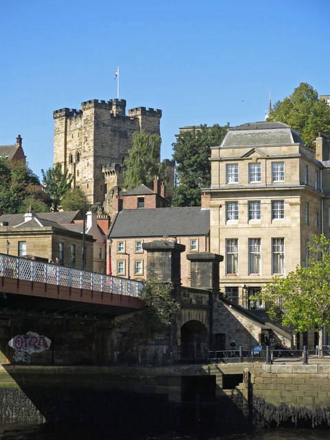
Image: © Mike Quinn Taken: 21 Sep 2019
After all the bridges on the Tyne, except for the Image (photographed by Dennis Lovett), were destroyed in the great flood of 1771, a 9-arch stone bridge was built on this site. This bridge was removed by the River Tyne Improvement Commission in the late 1860s, because large vessels were unable to pass beneath its arches, and the Swing Bridge built in its place. The stone abutment (centre) is a relic of the Georgian bridge https://www.portoftyne.co.uk/about-us/history/heritage-sites/heritage-sites .
Images are licensed for reuse under creativecommons.org/licenses/by-sa/2.0
Image Location
Latitude
54.968827
Longitude
-1.610247