Luckington houses [5]
Introduction
The photograph on this page of Luckington houses [5] by Michael Dibb as part of the Geograph project.
The Geograph project started in 2005 with the aim of publishing, organising and preserving representative images for every square kilometre of Great Britain, Ireland and the Isle of Man.

There are currently over 7.5m images from over 14,400 individuals and you can help contribute to the project by visiting https://www.geograph.org.uk
Luckington houses [5]
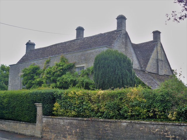
Image: © Michael Dibb Taken: 10 Aug 2019
Claremont is an early 19th century refronting of an older (possibly 16th or 17th century) house. Listed, grade II, with details at: https://historicengland.org.uk/listing/the-list/list-entry/1363814 Luckington is a village on the B4040 road between Malmesbury and Old Sodbury. The parish is on the county border with Gloucestershire.
Images are licensed for reuse under creativecommons.org/licenses/by-sa/2.0
Image Location
Latitude
51.553285
Longitude
-2.242835