Lewinnick Cove House
Introduction
The photograph on this page of Lewinnick Cove House by John Allan as part of the Geograph project.
The Geograph project started in 2005 with the aim of publishing, organising and preserving representative images for every square kilometre of Great Britain, Ireland and the Isle of Man.

There are currently over 7.5m images from over 14,400 individuals and you can help contribute to the project by visiting https://www.geograph.org.uk
Lewinnick Cove House
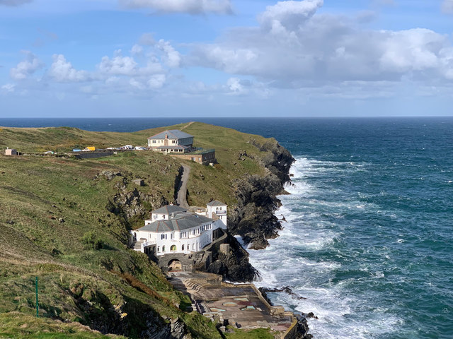
Image: © John Allan Taken: 5 Sep 2019
The house in the foreground dates back to 1910, when Mr Baker, a mining engineer from London, built it as a summer retreat. Over the years the plot was developed, including the terraces and swimming pool, and was completed in 1927. The locals call it Baker’s Folly, because they can’t understand why anyone would want to build a home on the north facing side of the promontory, only getting the sun for 3 months of the year. Unsurprisingly it is prone to damp. The property was sold after the death of Mr Bakers’s daughter and has now been converted into apartments.
Images are licensed for reuse under creativecommons.org/licenses/by-sa/2.0
Image Location
Latitude
50.411748
Longitude
-5.116825