Small holding development 1957, Old Town, Eastbourne
Introduction
The photograph on this page of Small holding development 1957, Old Town, Eastbourne by Crispin Purdye as part of the Geograph project.
The Geograph project started in 2005 with the aim of publishing, organising and preserving representative images for every square kilometre of Great Britain, Ireland and the Isle of Man.

There are currently over 7.5m images from over 14,400 individuals and you can help contribute to the project by visiting https://www.geograph.org.uk
Small holding development 1957, Old Town, Eastbourne
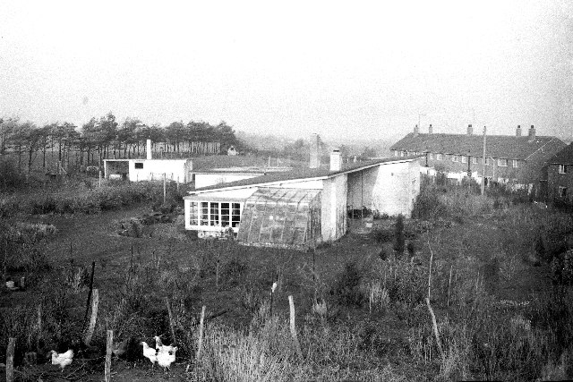
Image: © Crispin Purdye Taken: Unknown
This photograph is of one of several small holdings bordering the Willingdon golf course (line of trees in left of picture) and adjacent to the 1950s Green Way estate off Victoria Drive. The houses on the right are the westerly end of that development. These small holdings were of around 1 acre and located under the edge of the steep South Downs slopes. The bungalow, built in 1952 was demolished in 1961 to make way for a retired residential accommodation.
Images are licensed for reuse under creativecommons.org/licenses/by-sa/2.0
Image Location


Leaflet Map data © OpenStreetMap
Latitude
50.78416
Longitude
0.249917