72-74 High Street, Queenborough
Introduction
The photograph on this page of 72-74 High Street, Queenborough by Richard Rogerson as part of the Geograph project.
The Geograph project started in 2005 with the aim of publishing, organising and preserving representative images for every square kilometre of Great Britain, Ireland and the Isle of Man.

There are currently over 7.5m images from over 14,400 individuals and you can help contribute to the project by visiting https://www.geograph.org.uk
72-74 High Street, Queenborough
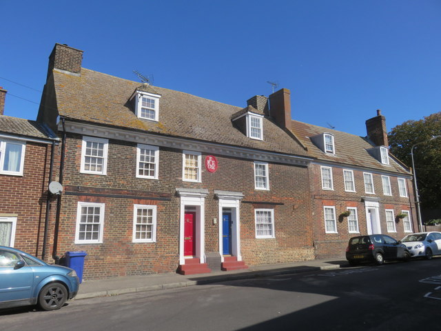
Image: © Richard Rogerson Taken: 17 Sep 2019
These houses are typical of several substantial Georgian townhouses on the High Street. The asymmetry would suggest that this was built as a single property. The front has a plaque with the date 1706 and the initials REE (possibly for Richard Evans and his wife). (Queenborough, Isle of Sheppy, Kent. Historic Area Appraisal, English Heritage Research Department Report Series no. 39/2006)
Images are licensed for reuse under creativecommons.org/licenses/by-sa/2.0
Image Location
Latitude
51.417304
Longitude
0.743725