Memorial to RAF Anwick Landing Ground
Introduction
The photograph on this page of Memorial to RAF Anwick Landing Ground by Adrian S Pye as part of the Geograph project.
The Geograph project started in 2005 with the aim of publishing, organising and preserving representative images for every square kilometre of Great Britain, Ireland and the Isle of Man.

There are currently over 7.5m images from over 14,400 individuals and you can help contribute to the project by visiting https://www.geograph.org.uk
Memorial to RAF Anwick Landing Ground
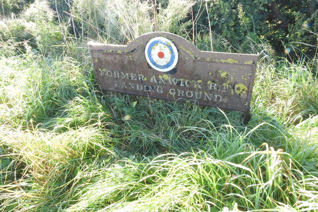
Image: © Adrian S Pye Taken: 8 Sep 2019
RAF Anwick was a landing ground / Flying field in WW1 and was also used in WW2 and a dummy airfield from 1939 for RAF Digby but closed in 1942, reverting to farmland. Remnants still exist and the hangar can be seen at the Anwick Garden centre (Grid ref. TF 1145 5077 = 53.042625,-0.339085)
Images are licensed for reuse under creativecommons.org/licenses/by-sa/2.0
Image Location
Latitude
53.05264
Longitude
-0.349011