Upper Peak Canal north of Danebank in Cheshire
Introduction
The photograph on this page of Upper Peak Canal north of Danebank in Cheshire by Roger Kidd as part of the Geograph project.
The Geograph project started in 2005 with the aim of publishing, organising and preserving representative images for every square kilometre of Great Britain, Ireland and the Isle of Man.

There are currently over 7.5m images from over 14,400 individuals and you can help contribute to the project by visiting https://www.geograph.org.uk
Upper Peak Canal north of Danebank in Cheshire
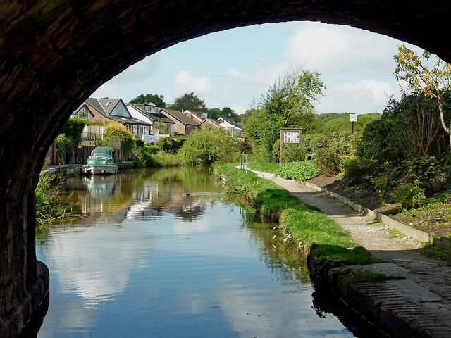
Image: © Roger Kidd Taken: 7 Sep 2014
This shows the Peak Forest Canal near Danebank, looking west through the arch of Dryhurst Bridge (No 26) towards Disley and Marple. The housing is in Ashwood Road.
Images are licensed for reuse under creativecommons.org/licenses/by-sa/2.0
Image Location
Latitude
53.36169
Longitude
-2.031065