Lane across Forde Bridge
Introduction
The photograph on this page of Lane across Forde Bridge by Derek Harper as part of the Geograph project.
The Geograph project started in 2005 with the aim of publishing, organising and preserving representative images for every square kilometre of Great Britain, Ireland and the Isle of Man.

There are currently over 7.5m images from over 14,400 individuals and you can help contribute to the project by visiting https://www.geograph.org.uk
Lane across Forde Bridge
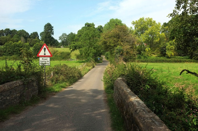
Image: © Derek Harper Taken: 27 Aug 2019
Whatley Lane continues the line of Park Lane across the small flood plain (hence the road sign) of the Axe, which is crossed in the immediate foreground by a bridge that gets two listings, one https://historicengland.org.uk/listing/the-list/list-entry/1118928 for the parish of Thorncombe in Dorset on this side of the river, and one https://historicengland.org.uk/listing/the-list/list-entry/1366418 for Winsham in Somerset on the other. The Liberty Trail follows this lane before turning right across the field along footpath 40UD116 CH 30/21 . By the blue notice ahead (warning of a weak railway crossing) is a junction with Ammerham Lane.
Images are licensed for reuse under creativecommons.org/licenses/by-sa/2.0
Image Location
Latitude
50.844412
Longitude
-2.907264