Graving Dock
Introduction
The photograph on this page of Graving Dock by Anne Burgess as part of the Geograph project.
The Geograph project started in 2005 with the aim of publishing, organising and preserving representative images for every square kilometre of Great Britain, Ireland and the Isle of Man.

There are currently over 7.5m images from over 14,400 individuals and you can help contribute to the project by visiting https://www.geograph.org.uk
Graving Dock
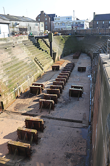
Image: © Anne Burgess Taken: 26 Aug 2019
The dry dock was built in 1853-1855 to accommodate Greenland whaling vessels. It was designed by Thomas Stevenson, and is 148 feet long and 54 feet wide. Stevenson wanted to use steam-drive pumps to empty it, but the harbour trustees were suspicious of new technology, and the cheaper option of horse-operated pumps was adopted. The cost was £6000, and it was financed by a levy of 6s 6d per ton of oil landed in the port.
Images are licensed for reuse under creativecommons.org/licenses/by-sa/2.0
Image Location
Latitude
57.504897
Longitude
-1.773534