Brook Inn, Plympton St Maurice, Devonshire
Introduction
The photograph on this page of Brook Inn, Plympton St Maurice, Devonshire by David Hallam-Jones as part of the Geograph project.
The Geograph project started in 2005 with the aim of publishing, organising and preserving representative images for every square kilometre of Great Britain, Ireland and the Isle of Man.

There are currently over 7.5m images from over 14,400 individuals and you can help contribute to the project by visiting https://www.geograph.org.uk
Brook Inn, Plympton St Maurice, Devonshire
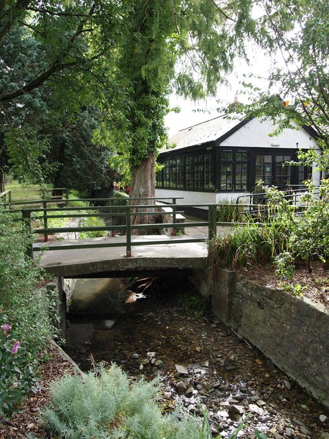
Image: © David Hallam-Jones Taken: 29 Aug 2019
Plympton St Maurice lies in a shallow valley flanked by two ridges. The ridge to the north is the ancient Ridgeway route into Plymouth whilst the high ridge to the south of the village is known as Ridge Lane. The southern ridge carries the A38 dual carriageway. This is Long Brook, the main water course that flows east to west through the southern part of the village conservation area. The brook is culverted for much of its eastern length where it feeds into the Tory Brook. Here it is seen passing to the north of a combined restaurant and pub complex. The inn was originally part of a farm but the whole site was converted for its present use in 1976. The southern edge of the village is 2-3 minutes away on foot, to the left. In very general terms this view is one looking towards the town of Ivybridge (10 or more miles away).
Images are licensed for reuse under creativecommons.org/licenses/by-sa/2.0
Image Location


Leaflet Map data © OpenStreetMap
Latitude
50.382109
Longitude
-4.045329