Ford at Carisbrooke
Introduction
The photograph on this page of Ford at Carisbrooke by Ron Strutt as part of the Geograph project.
The Geograph project started in 2005 with the aim of publishing, organising and preserving representative images for every square kilometre of Great Britain, Ireland and the Isle of Man.

There are currently over 7.5m images from over 14,400 individuals and you can help contribute to the project by visiting https://www.geograph.org.uk
Ford at Carisbrooke
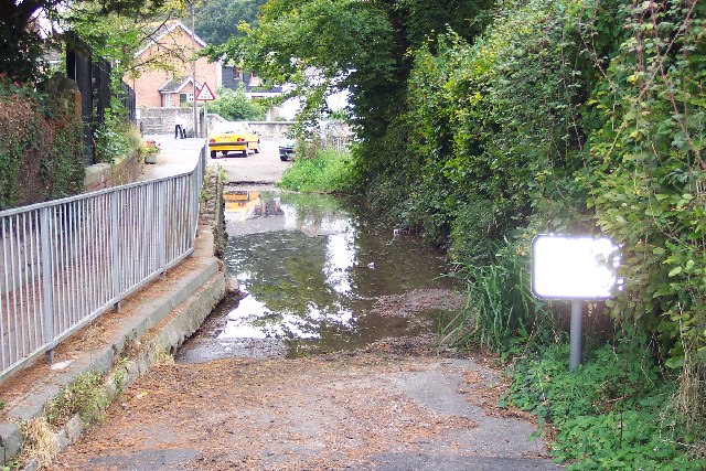
Image: © Ron Strutt Taken: 5 Oct 2005
The Lukely Brook flows right through the middle of Carisbrooke and there are several fords on minor lanes crossing the bottom of the valley. This is the easternmost one, now closed to traffic, at Spring Lane.
Images are licensed for reuse under creativecommons.org/licenses/by-sa/2.0
Image Location


Leaflet Map data © OpenStreetMap
Latitude
50.690511
Longitude
-1.310508