Forth and Clyde Canal [43]
Introduction
The photograph on this page of Forth and Clyde Canal [43] by Michael Dibb as part of the Geograph project.
The Geograph project started in 2005 with the aim of publishing, organising and preserving representative images for every square kilometre of Great Britain, Ireland and the Isle of Man.

There are currently over 7.5m images from over 14,400 individuals and you can help contribute to the project by visiting https://www.geograph.org.uk
Forth and Clyde Canal [43]
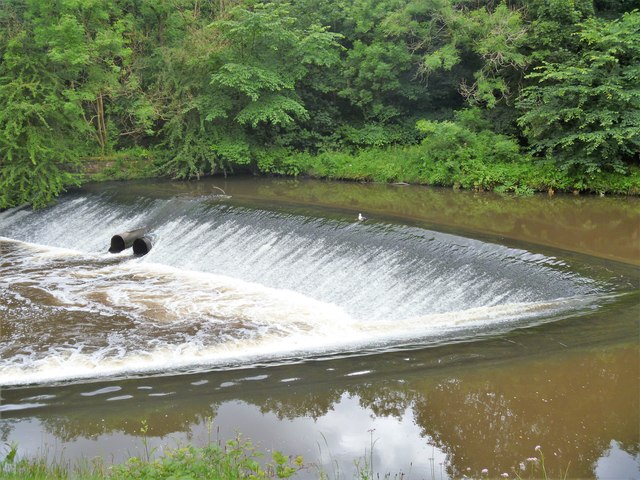
Image: © Michael Dibb Taken: 25 Jun 2019
The weir on the river just downstream from the aqueduct. The Kelvin Aqueduct carries the Forth & Clyde Canal over the River Kelvin. The aqueduct at some 400 feet in length was one of the largest built since Roman times when constructed in 1787-90 under the direction of engineer Robert Whitworth. Listed, category A, with details at: http://portal.historicenvironment.scot/designation/LB32316 The Forth and Clyde Canal was completed in 1790 and it provided a route for vessels between the Firth of Forth and the Firth of Clyde at the narrowest part (35 miles, 56km) of the Scottish Lowlands. Closed in 1963, the canal became semi-derelict. Millennium funds were used to regenerate the canal. The main line of the canal is a Scheduled Monument with details at: http://portal.historicenvironment.scot/designation/SM6773
Images are licensed for reuse under creativecommons.org/licenses/by-sa/2.0
Image Location
Latitude
55.89108
Longitude
-4.300149