Former maltings, Mansfield
Introduction
The photograph on this page of Former maltings, Mansfield by Alan Murray-Rust as part of the Geograph project.
The Geograph project started in 2005 with the aim of publishing, organising and preserving representative images for every square kilometre of Great Britain, Ireland and the Isle of Man.

There are currently over 7.5m images from over 14,400 individuals and you can help contribute to the project by visiting https://www.geograph.org.uk
Former maltings, Mansfield
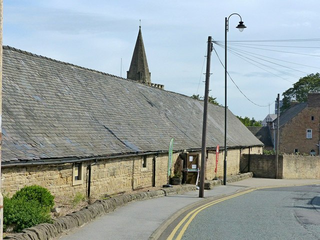
Image: © Alan Murray-Rust Taken: 21 Aug 2019
Built c.1800 for the Mansfield Brewery, Listed Grade II. Since ceasing to be a maltings, the buildings have seen a number of uses, currently hosting The Village activity centre. There is a benchmark http://www.geograph.org.uk/photo/6249451 on the corner of the high wall alongside the road at the far end.
Images are licensed for reuse under creativecommons.org/licenses/by-sa/2.0
Image Location
Latitude
53.143059
Longitude
-1.194155