Wycliffe Centre Horsley's Green
Introduction
The photograph on this page of Wycliffe Centre Horsley's Green by JOHN NIXON as part of the Geograph project.
The Geograph project started in 2005 with the aim of publishing, organising and preserving representative images for every square kilometre of Great Britain, Ireland and the Isle of Man.

There are currently over 7.5m images from over 14,400 individuals and you can help contribute to the project by visiting https://www.geograph.org.uk
Wycliffe Centre Horsley's Green
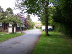
Image: © JOHN NIXON Taken: Unknown
Picture shows main drive building on left was sick bay in the centres time as a boarding school for pupils from Lancashire
Images are licensed for reuse under creativecommons.org/licenses/by-sa/2.0
Image Location


Leaflet Map data © OpenStreetMap
Latitude
51.646513
Longitude
-0.865411